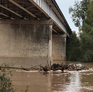
Brazos River Access Detail: The Sunnyside 529 Bridge
- Scott and Dottie Moore

- Mar 5, 2023
- 1 min read
The settlement of Sunnyside is about three miles east of where the FM 529 crosses the Brazos River.

Another Brazos River Bridge, another class 3 access, another piece of river to yourself. This bank is high and steep. The trail intersects the river at a right angle. There are no public bathrooms, picnic tables or grills.
Access is on the east bank, on the south side of the bridge. An asphalt easement passes under the bridge and turns into an unimproved dirt road down to the top of the bank.

Best practice is to scout these areas before a trip, if possible. This is for the off highway road conditions as well as the trail down the bank. Class 3 accesses are subject to the effects of weather, erosion, becoming overgrown, illegal dumping and vandalism. For explanation of river accesses ratings please read the articles Classification of Water Accesses and Scouting River Bridges & Accesses.
Upstream nearly 20 miles is the Hempstead 159 Bridge. Thirteen plus miles down river is the San Felipe 1458 Bridge.
For details on other river accesses please see the bottom of the article Classifications of Water Accesses.
Bonus pictures below. Thanks for reading!
MSM

The three pictures above are when the river was up and running! No way would I be on the river at that stage! The videos below are of the Brazos crunching trees.


Comments