


This year has primarily been one of small streams for me. The South Llano is mirthful and playful, Spring Creek is lively and serene and the San Bernard is a charming and forgotten river. Some of these qualities bleed over to the Brazos, but more than these things the Brazos is a large and powerful river.
Most of all the Brazos begets respect. Here I feel small in God's world. A brainstem consciousness gently emerges like a sandbar rising out of the river. The invisible membrane between life and eternity is thinner here. There is more to life than what we buy or will into existence. When I descend the banks of the Brazos and launch my canoe I enter another realm.
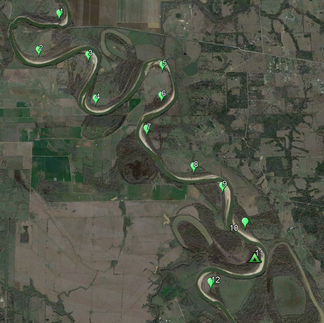
The Brazos River, from the 290 Bridge to the 159 Bridge, 14+ Miles:
For 100 miles downriver of the 290 Bridge this piece of the Brazos is the most remote and isolated. I was drawn to this river remnant and its pristine sandbars. One sandbar in particular, pulled on me like gravity. This wilder piece of the Brazos is close enough to the house that travel time and cost are not prohibitive. The distance between the bridges are close enough to canoe in a day. And, these accesses are by Brazos standards...easy...enough? Sort of?
Saturday May 25th, 2022 was a fair morning. Dottie shuttled Carlos and me for an hour in a van from Houston to the west side of the 290 Bridge. Here we launched into the Brazos River. The takeout was about fourteen river miles down, the 159 Bridge. The trip was only for a day, but it was challenge enough.
At the put in we found a dirt road (a dirt road, not a gravel road) I overlooked when scouting this launch in November. We appreciated the shortened portage.

We were on the water by 9:30.

Carlos and I are a strong team and we made excellent time. Soon the sounds of mechanized traffic faded. In less than two miles we came upon a most imposing obstacle.

I am going to spend a little time on this obstacle. I think it deserves it.

In the picture above you can see something oblong just below the water to the right of the pier. I suspect it is a piece of steel. Before the trip I studied this ruined bridge, finding satellite images of it when the river was low.
At the site, we half joked about a familiar heavy industry safety practice called a JSA, (Job Safety Analysis). In layman terms the workers involved in a heavy lift stop activity, discuss potential issues and hazards and sketch out a formal plan. Before the task begins all participants sign the JSA sheet, stating they understand and agree with the plan of action. Carlos and I considered the obstacle, discussed the details and decided to run the river on the east side.


The still images do not do justice to the impediment. Though this obstacle is not to the scale of the danger of the low water dams I have seen, it is easily the second most treacherous river obstruction I have come across while canoeing. We made it through, but we got no bonus points for style or elegance. The path we decided on lead us through two sharp bends in rapid succession. We discussed how the current would try to push us into the wooden pilings and made our run.
I remember making a corrective stroke and thinking my next effort would clear us of the hazard. Before I could make that stroke we were pinned against a piling. By brute strength and some help from an above we pried the canoe off the pilings. There. I have been transparent.
Many people have canoed and kayaked the Brazos, including this stretch of river. Some of these folks are more experienced and have more refined skills. Maybe some are luckier. Saying that, I am an experienced outdoorsman and we did not casually approach this obstacle.
My disclaimer/warning is this: we could have ruined the canoe and caused loss of gear (including cell phones). It could have ended the trip, almost before it began. We probably weren't in mortal danger, but the waters were pushy and the submerged obstacles unkind. It would have been a rough hike back to the bridge.
We did the best we could, but next time I am running this part differently. I don't have a plan other than running the river when it is a little higher or getting out on the west bank and making a short portage. I will not run it the way we did last time.
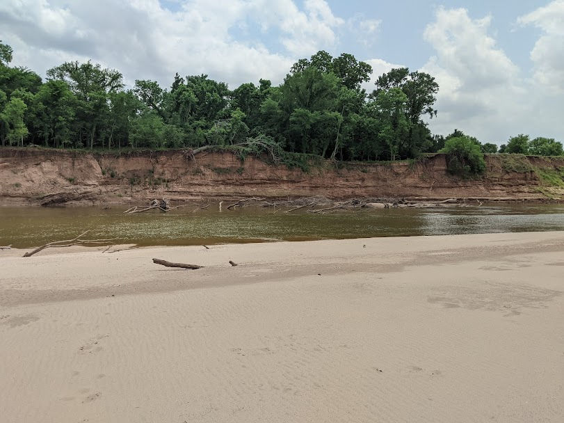
On the other side of the ruined bridge, that guardian of the Brazos, things went smoothly. The Brazos revealed new treasures at each bend and with every sandbar. After the small streams these past few years I was mildly struck by the magnitude of the Brazos.


Early in the trip we saw two bald eagles. One was mature, it's white head and tail strikingly visible at great distances.
In many of the images the generous cloud cover is evident. This was an appreciated amenity, as it was unusually warm for May.


Back to the trip.
We stopped for lunch about 1:00 at the seventh sandbar. This was a little past the seven mile point of the trip. We enjoyed the serenity, listening to the birds and insects sing. We sat on a washed up pecan tree and ate. Now and again I heard the call of the pileated woodpecker.

After lunch we relaunched. We had gone about a half mile down river and I was feeling unusually pleasant, cool and carefree. Then I realized my life jacket was still on the dead pecan tree at the #7 Sandbar! Back we went.
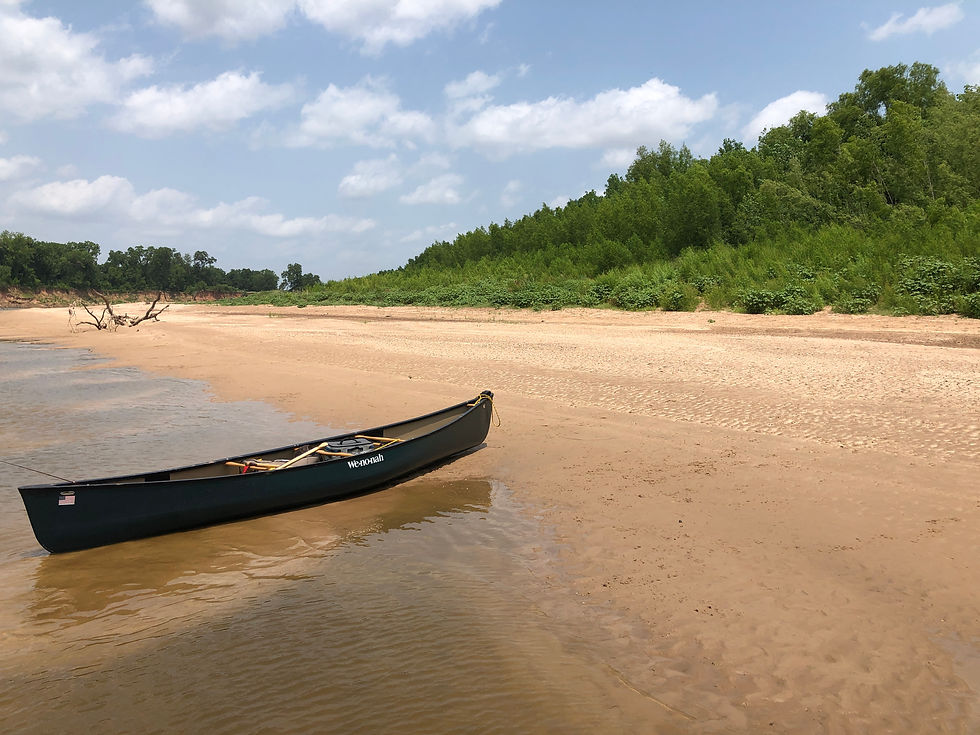
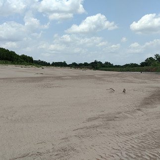
Some of the gems of this piece of the Brazos are the sublime grandeur of the bluffs and sandbars, the more natural state of the region and the innocence of the animals we encountered. Stretching my eyes across an expanse and not seeing telephone poles and wires, concrete and asphalt or artificially manicured landscapes with positioned trees is a joy.
Near the nine mile point a tiny island emerged in the middle of river between alternating sand bars. A wrecked tree had grounded in front of the island. On the the other side of that tree I saw something swimming. It was a coyote! I guess the coyote had been napping on the island. It swam from to the east bank. When those critters are wet you can see there is not much to them! To the bank it swam, then it loped up the bluff and watched us as we canoed down river. The coyote was already dry.

We continued downstream and met a three generation fishing squad. A small/medium gar was released as we went by. They didn't have a boat, I imagined they were land owners.

The trip went quickly. Before I knew it we were upon the sandbar I most wanted to check out. This sandbar combined the qualities of a good location between bridges, remoteness, isolation, quality and mass for a potential campsite for later river trips. We disembarked for an on shore recon.


The accommodations did not disappoint. We could hear some equipment across the river in the distance. Hopefully it was only farming activities. At any rate, this #11 Sandbar, at the eleven and a half mile point is a place I want to camp.
Through the marvel of technology I was able to update Dottie the progress of the trip. In doing that we were able to coordinate the timing of our extraction from the Brazos. I was grateful for the available cell phone service. Its no fun for either party to wait under the bridge for extended periods. (My wife said she was on her way, and told us to slow down!)
We saw a deer between the #11 Sandbar and the 159 Bridge.


Soon enough we rounded a bend and the 159 Bridge emerged from the trees, see the right photo above.
My bridge scouting revealed the east bank was preferred to the west bank for take out. Initially I figured we would climb out just upstream the bridge at the head of the granite rip rap. We soon discovered leaving the Brazos would not be easy.
On the second attempt we wound up climbing out the steep east bank directly under the bridge. This was the most physically challenging part of the trip, more challenging than the launch or running past the ruined bridge. At the takeout we dealt with deep mud, concrete rip rap and rebar, various illegally dumped items, thick undergrowth, a twisted path through new growth trees and a tangled tapestry of poison ivy. By 4:20 we had the canoe at the top of the bank.


So, what's my take on this piece of the Brazos?
It's a fantastic trip to canoe. To enjoy it demands the proper outlook along with mental and physical strength. Stamina too. These things and our skills are at least as important as the gear we used.
There are a few natural obstacles and hazards. Poison ivy is one of them. The effects of poison ivy can linger for weeks or longer if not treated. This plant is plentiful along the Brazos banks.
Speaking of banks, the Brazos banks are high and steep. There are no improvements to aid anyone launching a boat. These banks are slip/trip hazards. On the put in I slipped on some silt covered with a veneer of sand. I was near the water's edge, with the canoe overhead, so be careful.
Saying that, the most perilous obstacles of this day trip were man made. Other than the ruined bridge pictures of these things are not needed. Between the put in and take out points these things don't matter.
The weather is always a consideration, whether it is warm or cool, windy or rainy. The general remoteness of the river requires some foresight and planning. If you don't bring it you will do with out. This awareness tends to evolve as the trip matures. Eventually the reality that "We are beyond the point of no return..." drapes over the mind.
On the river we did not line or portage the canoe over any barely submerged sandbars. Though we saw some spectacular fish I did not catch any. There isn't much shade on this part of the river. If you don't train for the heat and you make a summer run, (or in this case a spring trip), it probably wont go well.
I am not taking my children on this stretch until they are older, stronger and more experienced. The ruined bridge and the takeout are the major reasons. Also, don't underestimate the Brazos by thinking it is a lazy and muddy river. It is powerful and relentless. Get sideways with it, or allow yourself to get caught between it an an immovable object and the end results might surprise you.
On the take out...I am going to re-scout the west bank of the 159 Hempstead Bridge. If it is not any better than my notes from other recons I will strongly consider adding a day or two to the next trip and taking out at the 529 Sunnyside Bridge.
Canoe the Brazos, but be prepared and overcome the obstacles and mistakes. The reward for perseverance is rich.
Below are more pictures of the trip. Enjoy.
Thanks for reading!


Really nice review on this sretch of the Brazos river. From the TX 290 bridge all the way to the Gulf of Mexico are great stretches of the Brazos to be explored, one bridge access being only 15mi from my home. With the May/June drought, one may need to wait until Fall for a bit more flow.