

I guess the Texas coastal rivers are an acquired taste. If you didn't grow up on them, your mental image of a river probably won't include flatwater, sandbars, gravel bars, bluffs, willows, cottonwoods and the sycamore trees of these streams.
The rivers running through the Texas coast are frequently described as slow, muddy, lazy and meandering. Often linked to these mildly negative connotations are expressions that such and such river is "...suitable for anyone at any skill level or physical conditioning..." My canoeing experience contradicts these notions. Underestimating these rivers, their environments and choosing a canoe partner without considering their physical fitness and mental stamina are not my recommendations!
When it comes to equipment, another article...
Welcome to the Urban Frontier blog!
My exploration of the Trinity is incomplete, but I finally have some meaningful pictures to share with you. These are a "whiff" of the Trinity River. Please join me on my recons of some of the lower reaches of the Trinity River. Click on the links below or scroll through the text below.
Whatever your mental image of a river is, if you invest yourself into these Texas streams they'll grow on you. I am often delighted with the various coastal rivers of Texas. May it be the same with you.
The Liberty 90 Bridge Upriver Recon
For 500 years the conquistadores overlooked the true Texas treasure of the lower Trinity River. My efforts to canoe this water has been delayed by one thing or another for a while.

December of 2023, I made two forays into the Trinity. For these trips we accessed the Trinity via Lake Charlotte, Mac Bayou and Sulfur Cut. Here I found the river big and wide. Both times I ventured the Trinity I found slack waters, see the article Seize the Day! ~ first in a series of 4, as posted above.
After December 2023 my attempts to explore the lower Trinity River were thwarted by the high waters of 2024. The Trinity stayed at flood stage, or two high for canoeing, for six months or more.
Fortunately the 90 Bridge was unaffected by the 2024 high waters. Also, the railroad bridge construction is finished now.
In my earlier bridge scouting, I found slack currents at the Liberty highway 90 Bridge. This coincided with my findings down river in December. Maybe the Trinity would permit an upriver recon from the 90 Bridge? September 29th 2024 my son Leif and I made the up stream effort.


The river was a foot above 2023 normal, but it was a beautiful day. As my scouting indicated, the current was slow at the bridge. We soon discovered why the river was so slow at this place. Directly upstream were two sharp, 90 degree turns, one immediately following the other. These restricted the flow of the river, but a mile up from the bridge the current was swift!
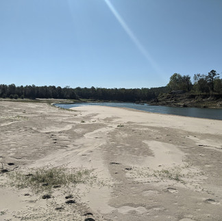
By this point we were halfway up the second sandbar. Here we took an onshore break and explored this above water shoal, the one on the east bank. This is a superior sandbar, being long, high and with a large flat area. Though we were not miles away from the bridge the "limited wilderness" felt thick here.
Limited Wilderness is my concocted phrase for the combination of isolation and remoteness. Isolation being the lack of boat and foot traffic and remoteness being the distance from man made structures. Remoteness is especially the distance from occupied buildings and facilities, but also barns, bridges, pipelines, powerlines, agricultural and industrial developments and so on. On rivers cutting through the former prairie like the Brazos or Colorado, the limited wilderness often incorporates a riparian edge. There is a riparian edge on the lower Trinity river, but this river cuts through large, intact chunks of a remnant wood. There is deforestation, but it isn't always the dominant feature.


Back on the sandbar I found the bank consisted of a narrow underwater shelf with a sheer drop or mini bluff, below and above water. Above river, higher waters had deposited a flat, top shelf of sand. Some of these characteristics, I am learning, are the tells of swift currents.
We ate and drank what have become our river staples, peanut butter and water. We walked the length of the sandbar and found the typical pig and deer tracks. There were no vehicle tracks.
We saw a large white bird with black wingtips. I would have taken it for a whooping crane, but the black markings were not right. I got one picture of this great bird. The quality of my image is similar to that of the bigfoot Patterson-Gimlin film. Nevertheless, I am pretty sure it was a wood stork, which was pretty cool to me.

With our food and water settled, I lined the canoe nearly half a mile to the top of the sandbar. In the end this was strenuous, but we liked it better than canoeing in the strong current. Lining the canoe was also easier than portaging it, that's for sure!


On the upper portion of the sandbar where the current was even quicker, the underwater shelf disappeared. To continue upriver I was forced to walk on the top shelf of the sandbar.
By and by the shelf fell out from under my feet and I had to double step! Some sand made it into my canoe. The sand that fell in the river was whisked away. Nothing happened, but by this point I recognized wearing a life jacket would have been prudent.


In the current at the upper end of the sandbar, I made a find. I recognized the black shape in the clear water immediately, a fossilized herbivore tooth! My daughter Rose had found one on Spring Creek, but this was my first find of this kind.

From here we leap frogged to the third sandbar upstream the bridge. This one was on the west bank. Leif wasn't on his A-game this day. Instead of pushing him I decided keep the trip enjoyable. We took another break on this sandbar and assessed our condition. This place wasn't as big as the previous break area, but it was still generous in size. Listening to the pileated woodpeckers, I absorbed as much of the Trinity as I could. We decided to go upstream a little bit and turn back.

Back at the bridge we met some fishermen in boats. A pattern in my encounters with fellow outdoorsmen on the Trinity began emerge. Everyone has been respectful, courteous and enjoyable. It was a great trip and I got to know a little more of the Trinity River and its people.
The 3278 Bridge to 59 Bridge Recon
By November 2024, I had made two recent recons on the portion of the Colorado River that the LCRA named the Lower Basin. So, when Leif and I reconned the Trinity later in that month my perspective of the Trinity was uniquely qualified and fresh. Mentally, this Trinity trip connected with the Colorado trips. A study of two rivers emerged, one of comparisons and contrast.

This portion of the Trinity River had witnessed the savage floods and high waters of the first half of 2024.

My son Leif and I met my coworker Jim Nixon, at the 59 Bridge and boat ramp. Jim provided the shuttle of this A to B run. While we at the 59 Bridge I surveyed and judged the status of the access.
Only the most vicious foods affect class 1 accesses. There was some bent metal on one of the piers. Piled up on the boat ramp was an end dump trailer load or more of sand. It blocked one side of the ramp.
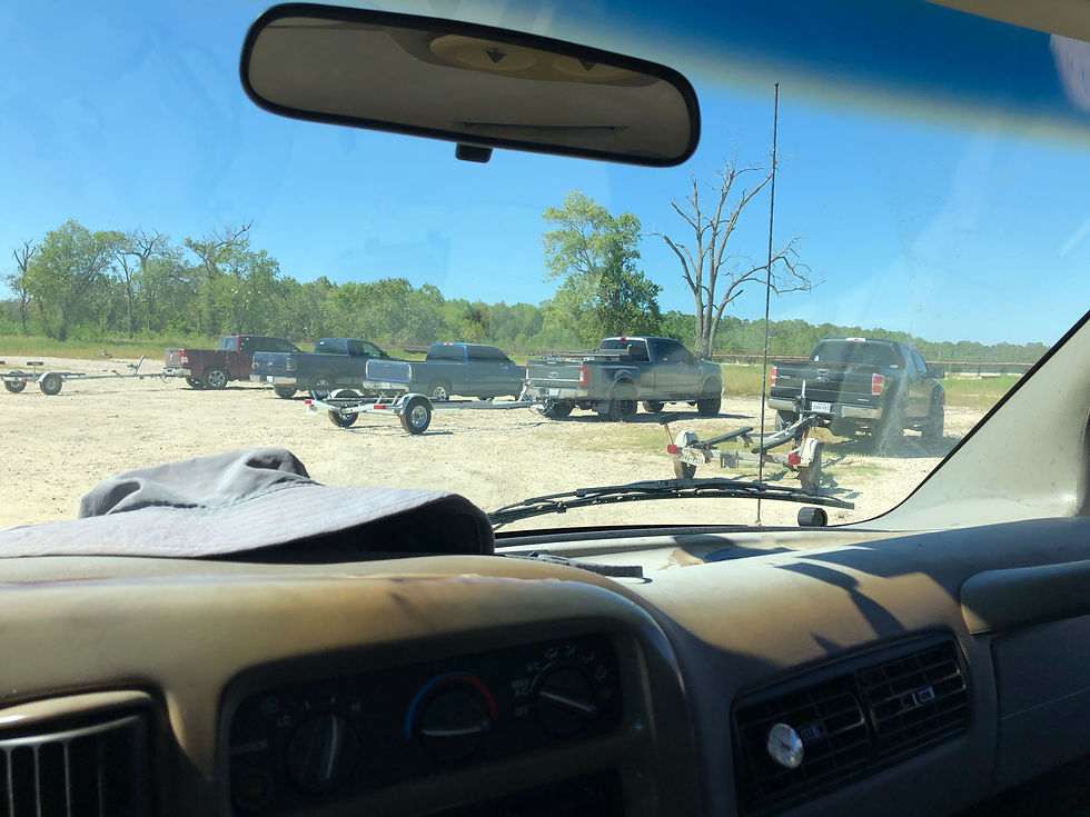
This, the 59 Bridge, would be our takeout. I parked my van and we loaded the canoe and our gear onto Jim's trailer and four wheel drive pickup truck. The upstream 3278 Bridge and Browder's Marina were our destination. The pictures below are from the 59 Access.


At the trailhead, the weir directly below the Livingston Dam had been blasted out by the record release. Those forceful currents had also washed out part of the 3278 Bridge. There was still equipment staged below the dam, but the weir looked finished. The repairs on the 3278 Bridge however, were still underway. See the images below.


With the 3278 Bridge under reconstruction/repair, only one lane was in service. At Browder's I paid the $15.00 charge to launch. We went to the west bank access first. There we found the concrete ramps closed, likely washed out at the bottom. On the top of the bank the bathroom and cleaning station I reported on in the Trinity River Access Detail: The Goodrich 3278 Bridge, were gone. Below are some pictures from the west side of the 3278 Bridge access to the Trinity.


So we went to the east side. I didn't get any pictures of the east bank access until we were on the water. It looked like one of the east side ramps was open, but Jim used the four wheel drive on his truck to get us into a nice...err, class 1, or something access.
For this canoe trip, Leif and I would not be running upriver. We would be taking it easy, going with the flow, downriver. We were on the water at 11:00.

Like the Lower Basin of Colorado, the current of the Trinity was swift. Also like the Colorado, the lake released water was relatively clear. After those similarities it didn't take long to find the differences between these two Texas rivers.
First off, the Trinity is wide, normally 100 yards. Sometimes it narrows to 75 yards but there are places where this river is well over 100 yards wide. Being that wide made it possible to see a mile of river at a time in places.
Other differences I find in the Trinity are the contrasts in their natural environments and the developments in their river basins. Unlike the Colorado that runs through a remnant prairie, the Trinity River cuts through the remains of the woods. Deforestation is a factor on this run of the Trinity. In studying the satellite images from Google Earth I would guess the deforestation factor is about 50%. Compared to my recent Colorado trips, agricultural development on the Trinity is light. There is some urban development on this run but it is moderate or somewhat removed.


Visual evidence of urban development was light. There were bank fishermen at both bridges, and on the water we met three bank fishermen in two parties. We encountered no boats.
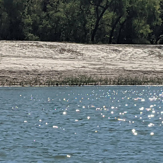
The houses I saw near the banks were wrecked by time and high waters. There is no part of me that celebrates the misfortune of others. Early in this trip there are some nice superior sandbars. One of the sandbars near a development was overrun by truck and ATV tracks. See the middle image posted above.

On the river, after I warm up and settle into a rhythm, I transition to a sublime state. In that thin space I am less aware of myself as a cog in the societal machinery and identify more as a component of the natural state. As a visitor to the more primeval realm I can momentarily slip some of my responsibilities and burdens. Here, time is not so linear. Connections with recent trips merge with the thinning memories of those from my youth.
A moment early in this trip I found the canoe sliding by a rough sandbar. Leif and I watched thick bodied, scaled fish dart between the canoe and the bank. Shore birds ran and took flight and I mused at the grapevine covered trees. I was more carefree than I was accustomed too, this sublime stuff is cool!
Wait a minute, something is missing! Ahh, yes. That faithful companion so predominant of coastal Texas, that steady, oppressive and domineering... warmth. On so many trips over the previous months and decades past, I canoed with that stifling, smoldering, smothering heat. The heat draped over me on those trips the way the muscadine grapevines weigh down the cottonwoods and sycamores along the riverbanks. Did I really miss that aspect on this trip?
Yeah, I kind of did. Warm weather is such a constant along the Texas coast. I felt a paradox of superficial responses. Without the heat slowing me down I felt like I was cheating. I kind of missed it, and at the same time I revelled in the temporary freedom from that low level misery.
Regardless the lack of summer weather, Leif and I made an on shore stop on the most isolated and remote sandbar. Early in the trip with mild conditions, we left the tarp kit in the canoe.

We couldn't see it from the high sandbar, but across the river and behind the trees, there was a community. While we explored our side of the river, two ATVs were exploring their bank.


The sandbar was proportionate in size of the river, big.
My expectation of seeing deer and hogs were unmet. Must have been our late start. We did see three bald eagles and two alligators. Seeing the alligators this far up and in proximity to the moving currents was not anticipated.
Back to comparing the Trinity to the Colorado. On the Trinity I saw none of the duckweed, elephant ear, water hyacinth, no broken mats of floating filamentous algae and none of an underwater plant I call horsetail fern. I may have identified the underwater horsetail fern as ranunculus fluitans lam. These plants are, I believe, the reason the Lower Basin of the Colorado River was so pretty and clear. Where the underwater horsetail flourished, the Colorado was especially clear. From a non scientific perspective, I figure these are biofilter plants.
Of the plants mentioned above, the Trinity was clear of them. Apparently the water below the Livingston Dam lacks the run off of lawn and agricultural fertilizers. I believe those run-offs fuel the aquatic plants found on the Colorado River. I haven't been on the Trinity enough to find the mussels, but I hope to locate them in the upcoming trips. These creatures are likely a gauge of stream health.


On the perceived biofilter plants on the Colorado, I am only writing from a rudimentary comprehension of these things. I haven't studied the water test or the impacts these plants have on the river. I most often notice these plants in waters near high densities of human populations.
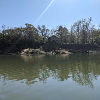
There were some other mild surprises in store for this trip. One of the nicer ones was the sighting of a large and high hill below the last sandbar. This was unexpected scenery for being so near the coast!
Here and there rock outcroppings jutted out from the banks. The river is very wide and these obstacles are easily avoided.

One "cataract," about 7-3/4 miles down from the launch, stretched across the river. We could hear it a hundred yards upstream. In this instance, for us, this time, the sound was worse than navigating the feature. We made slight adjustments, found a broad V, and traversed the feature without issue. One hundred yards downstream this detail I was still noting the boiling waters. Evidently there is some power in this obstacle! I try to not underestimate these things.
Three quarters a mile down from the cataracts a powerline crosses the river. Here is why I value experience rather than just scanning the river with Google Earth. On this river trip, my vision suddenly got much sharper!
About a hundred yards up from the powerlines Leif spotted and commented on the disarray of some pipelines.
Underneath the powerlines lie a set of pipelines. In my Google Earth surveillances I had overlooked them. Ordinarily pipelines are of no concern. They pass either high overhead or deep below, but these pipelines were functionally wrecked. Either that or they are obsolete and abandoned scrap left littering the river. I get it, people need natural gas or whatever is in them, I don't begrudge these forms of development. But if they are abandoned they need to be removed. If they are in use these need some service.
Usually underwater pipelines have signs posting warnings not to dredge or anchor. I saw no signage. Regardless, I had overlooked them on Google Earth. What was coming I wasn't expecting.

Coming from an oilfield background, the two pipelines looked wrecked and abandoned. Level, straight, horizontal, right angle, perpendicular and parallel are words I connotate with pipelines. None of those words were applicable to these attempts. In the moment I was amused, thinking, "Well, I guess this is the best they could do! Apparently they got the job done." and "If the clients are not complaining then no one cares!"

I was busy taking pictures. I could not have been more beguiled had I seen a sasquatch, a Chupacabra, a yeti or the missing link. Had I ignored this industrial freak show and paid attention to the river I may have avoided a few more grey hairs.
Immediately upstream to my right, I noted a large tree hung on what I perceived to be the river bottom. Maybe it was two trees, no big deal. I remember thinking "Well, I guess these wrecked pipelines don't leak." Suddenly upstream something was just below the water's surface, spanning the river and very close. "No escape!" flashed in my mind. Our only path was to go over what ever was disturbing the water. I barely had time to make Leif get into the bottom of the canoe. I kneeled low in the canoe and hoped for the best. In passing over the thing I realized the dead trees, were hung on a third pipeline!
And so without event, we passed over that man made river feature. I relished in the embarrassment of my overreacting. Nothing happened. We survived. All that consternation for nothing! "Well, what's the worst that could have happened? Maybe we would tump the canoe over? Maybe? Probably we would have just rubbed across the pipe and got a jolt and a start. We always wear life preservers, we aren't packing much gear. A little water never hurt anyone!" I settled my mind with these thoughts and rationalizations. The further downstream we went the more my wits recollected. Eventually I figured the wreckage we witnessed was the result of the 2024 floods.
Back home, my Google Earth studies suggested something other than my on river assumptions. See the images below. The dates on the left and center pictures are from 2012 and 2023. The picture below and right is the path Leif and I took.


Google Earth images indicate the pipelines were installed between 2009 and 2012. Apparently their installation was sloppy or high waters and strong currents wrecked them soon after. River height determines how much of these pipes emerge from the surface. As stated above, we ran the river while staged at just under five feet at the 59 Bridge.
The date on the image below is from December 14th 2023. On that day the USGS measured the gauge height at the 59 Bridge between 4.52' and 4.72'. Judging by the shadows in the picture the image was taken before noon and the river may have been about 4.62'. Splitting hairs I guess, converting the measurements to inches, 4.52' and 4.72' become 54.42" and 56.64" for a difference of 2.22 inches. Leif and I ran the river at a nominal 4.99' which is 59.88 inches. In a canoe, three to nearly six inches can make a big difference.

There is probably a better way to run this feature than the way we ran it. There may be a better way to run it than my proposal above. There is some probability that I am overreacting and overthinking this feature. Well, maybe I am more careful than I used to be. What I don't like the most is that these things pretty much span the river and were barely under water. Maybe if the river is low, just portage the event? The easiest solution is to just make the run when the river is staged at 5' or above.
Assess your risk, skills and stamina as always, but this 9.5 mile run is worth the effort once you arrange the shuttle.

At the beginning of the trip I was keen to notice the swiftness of the current. As the trip matured I got used to the speed. The long fall shadows caused us to push on rather than loiter. I have been on trips where the time and distance did not seem to parallel. Whether the time passes too fast and the distance tarries or visa versa, it can be discombobulating. I am more aware of these misaligned concepts in the fall and winter, when the days are shorter. In reality, we made good time and the swift current helped.

Even as the trip was nearing the end I noticed another difference between the Trinity and Colorado rivers. Almost all the Trinity tributaries were flowing with some force.

On other rivers I frequently find the mouths of creeks silted in. The force of the superior stream effectively dams the inferior. In these instances the tributaries waters slow down, stack up and the sediments fall out. The mouth of the inferior stream silts in.
This was not the case on the Trinity. Here the tributaries had enough force to push small deltas into the river. Interesting!


And to pay homage to Homer, our mini odyssey started where it began, at the 59 Bridge. We landed at 2:30.

Thanks for reading!
MSM
Comments