The Texas Trifecta Tour
This trip, I call the Texas Trifecta, for no other reason than you can paddle three running waters in one day, canoeing from one to the next to the next. This tour would include the West Fork of the San Jacinto River, Spring Creek and Cypress Creek. The San Jacinto and Spring Creek at these stations are medium streams. So is Cypress Creek at the lower portions we traversed.
I studied all three streams and when a weekend lined up where all three were nearly normal, only a foot or so high, we went. It was now or maybe wait a long time...again. So on July 20th, we took the chance. It turned out to be a good day!
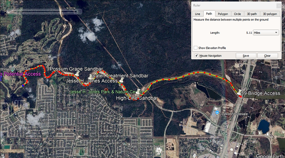
My son Leif and I launched from the southern bank at the 59 Bridge of the West Fork of the San Jacinto River. Recent floods and prolonged high waters had washed sand three foot high in places under the bridge.
I wound up parking several hundred yards away but I was glad to have access to the SJWF (San Jacinto West Fork). Sand wasn't the only thing the high waters left. A veneer of silt covered the sand at the shore. My usual hundred yard or so portage to the launch was covered with that slick icing. I slipped a couple times scouting near the shore for an easement to the water. Once I found myself slowly skiing to the water, backwards! Lightning quick Leif grabbed my arm, his reflexes prevented my awkward crash. One of the slips tweaked my back. Later in the trip, discomfort revealed the slight strain.
Though anticipated and planned, this trip had a throw together element I couldn't shake. The trip wasn't snake-bit, but it was definitely a what-you-make-of-it event. We got a later start than I preferred. Even though we brought the tarp shelter, the stove and the fixings for a hash, these things were not to be. The adventure picnic would wait for another trip.
This was a warm day and under the bridge was noisy. Nearly 150 yards away I watched some kayaks launch from the north bank. Second thoughts invaded my mind. "What are we doing here?" Eventually we found an alternate launch on the southern bank. Happily the portage was short and safe. Leif surprised me by packing the heaviest gear to the canoe.
On the water under the bridge we threaded the canoe through the tree carcasses lodged in the pilings. Its a good thing there wasn't much current under that bridge! Up the river we went!
On the river our troubles faded. Soon were were at the mouth of Spring Creek. Not far up that creek we saw two bald eagles. One was a nearly mature specimen, the offspring I am sure, of the other eagle. I got some photos of that younger bird. See the images below.
Eagles will not share a tree with birds that are not offspring or a mate. Other birds just flee from the eagles. I have not seen eagles share anything with other birds. Not hunting grounds, the sky and especially not a tree. I believe the two eagles we saw were related. Any time I see a bald eagle I count it a victory.
We paced ourselves in the warmth, stopping three times to rest and enjoy the sandbars. We drank lots of water, and on this trip my awareness of the power of peanut butter begin to dawn on me.
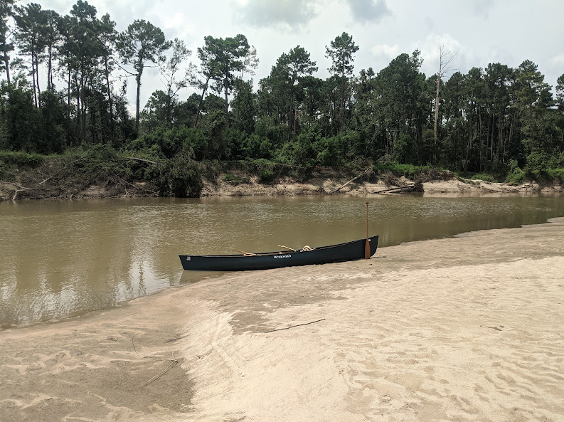
The first sandbar we stopped on was on our right. A power line crossed it, so we called it the High-Line Sandbar. We drank water and ate peanut butter. Soon after relaunching we passed the Jones canoe ramp.
We stopped at a second sandbar about a mile up from the Jones canoe launch. We sat on a log in the shade of some trees. Honeybees buzzed overhead, working a possum grapevine that draped the trees. We found two of those tiny grapes in reach and ate them. I was familiar with the tough hulled and sour muscadine grapes, but these were tender and sweet. I called this the Possum Grape Sandbar.
The current was strong at this sandbar, especially at the top. We needed to recharge if we were going to go further upstream. Resting, eating peanut butter and drinking water, we enjoyed the creek view. I walked out to the point of the sandbar and looked upstream. Four hundred yards away my eye caught a subtle hint, a pointed vein of land protruding into the water. I said to Leif, "The mouth of the Cypress is in sight. Do you want to try to make it that far?"
"Yeah," he said watching the creek slide by.
In order to shorten our time in that determined torrent, I decided to line the canoe. It was pretty awkward. The current kept pushing the canoe into our bank. Leif pushed it out again and again. The quicksand at the top of the sandbar added another dimension to our efforts. We made it maybe 100 yards up the bank when we sank the second time. After that, we made an impromptu jump into the canoe. Leif's powerful draw strokes and steady determination helped correct the canoe from our improvised and imperfect upstream launch. Once straight we sprinted the canoe 300 yards and across the mildly confused confluence the Cypress. On the other side of the turbidity the Cypress waters slowed and backed up as they piled into the superior Spring. We took the opportunity in this slack water for an in-canoe break. We cleaned some of the silt and gravel from our shoes and the canoe.
I told Leif there was a pedestrian bridge a little upstream and asked him if he wanted to see it. He was good to go. Soon we were on the other side of that bridge.
The differences between Cypress Creek, Spring Creek and the San Jacinto River were becoming apparent. Some were subtle, and some were not.
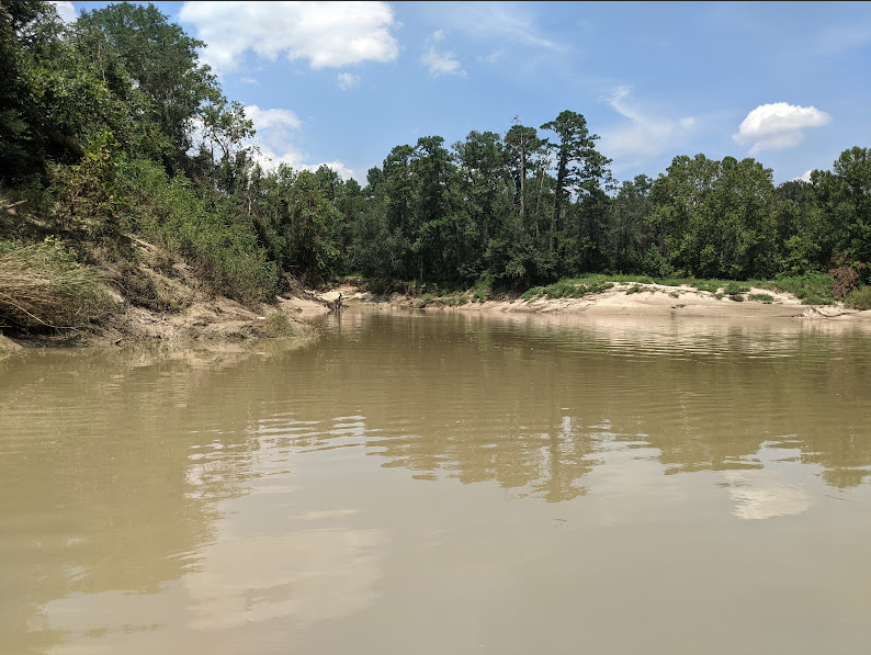
The Cypress has a deep U-shaped channel and steep banks. This channel shape and the lack of sandbars were a little surprising given that Spring Creek is just a few hundred yards away with its shallow, sandy bed and lots of sandbars.
Most apparent differences in the Cypress Creek and the other streams were the lack of the San Jacinto's gravel pits and the absence of the Spring Creek hiking trails. Though urban development is as or more aggressive here, Cypress Creek felt more secluded than her sisters. At least the part we were on that day felt cozy and isolated.
I asked Leif if he wanted to go up as far as the Cypresswood Drive Bridge, and this time he hesitated. So I said, "Let's give it a try." We soon found ourselves on a long straight with a forceful current. Struggling to progress, I assessed the power of the stream and Leif's remaining strength and stamina. The steep banks and deep channel would make lining difficult. We were at the halfway point of the trip. There were no guarantees we wouldn't face headwinds or a difficult landing on the return leg. We turned around.
Crossing back over the Spring-Cypress confluence I noted the momentary push from the turbulence. Downstream we stopped at the High-Line Sandbar again. This time I decided to land at the top. The reason I mention this is because we again, ran into some quicksand.
A couple things about quick sand. This time when I walked back over my trail, is when it gave out. And when it gives out, it happens suddenly. Leif and I both sank twice on this sandbar. The second time I sunk nearly to my waist. Fortunately Leif was nearby and pulled me out. I am glad it wasn't deeper! I didn't do a scientific survey, but I found the quicksand at the top or head of both sandbars.
Back at the canoe we ate some peanut butter, washed it down with some water and relaunched. Guess what? When we got back to where we had first spotted the eagles, they were still there! The bigger one flew across the creek with something in its feet. I suspect it was a fish, but I wasn't able to confirm. It landed in a tall pine and proceeded to eat its kill.
From there on it was uneventful and pleasant. With minimal excitement we laced the canoe through the forest of tree skeletons lodged in the structure of the 59 bridge.
It took us three hours with two stops to get to the turn around point. The return five plus miles to the 59 Bridge took two hours with one stop. I figured for this run on this day every mile paddled upstream was roughly equivalent to 1-1/2 downstream miles. I don't log upstream miles differently than downstream miles, but I figure we could have as easily covered 12 to 13 miles on a typical 2 mph, type A flatwater. Hopefully the Brazos River 529 to 1458 run is in our future.
Back on the San Jacinto bank, Leif unpacked the canoe while I retrieved the van. On loading the van, Leif again selected the heaviest gear to portage. I was proud and impressed!
Thanks for reading!
MSM
For further reading click on the links below.
Spring Creek Access & Water Details
I used most of the best pictures in the article above, but below are some bonus pictures of the Texas Trifecta.


Comments